Odisha Map – An Overview of the State’s Geography and Attractions
Odisha, also known as Orissa, is a beautiful state located in the eastern region of India. It has a rich cultural heritage, a diverse landscape, and a fascinating history.

The state is known for its beautiful beaches, ancient temples, and lush green forests.
Odisha Map
To explore the state and plan your trip, a map of Odisha can be extremely helpful.
Geography of Odisha
Odisha is situated on the eastern coast of India, along the Bay of Bengal. The state shares its borders with West Bengal to the northeast, Jharkhand to the north, Chhattisgarh to the west, and Andhra Pradesh to the south. The state covers an area of 155,707 square kilometers and has a population of over 41 million people.
The topography of Odisha is varied and includes coastal plains, rolling uplands, and hills. The state is home to several major rivers, including the Mahanadi, Brahmani, and Baitarani. The Mahanadi river is the largest river in the state and is an important source of water for irrigation, hydroelectric power, and transportation.
Attractions in Odisha
Odisha is a popular tourist destination and has a lot to offer visitors. Some of the major attractions in the state include:
Puri Beach: Puri is a famous pilgrimage center and a popular beach destination in Odisha. The beach is known for its golden sand, clear water, and beautiful sunrises and sunsets.
Konark Sun Temple: The Konark Sun Temple is a UNESCO World Heritage Site and is one of the most famous temples in Odisha. It is known for its architectural brilliance and stunning sculptures.
Chilika Lake: Chilika Lake is the largest brackish water lagoon in Asia and is home to a rich variety of flora and fauna. It is a popular destination for bird watching, boating, and fishing.
Simlipal National Park: Simlipal National Park is a beautiful wildlife sanctuary and is home to several endangered species, including the Royal Bengal Tiger and the Asian Elephant.
Getting around Odisha
To explore the state, it’s important to have a good map of Odisha. The state has a well-developed road network, and several modes of transportation are available, including buses, trains, and taxis. The state also has several airports, including the Biju Patnaik International Airport in the capital city of Bhubaneswar.
Odisha is a beautiful state with a rich cultural heritage and diverse landscape. It has several major attractions, including beautiful beaches, ancient temples, and wildlife sanctuaries. To plan your trip and explore the state, it’s important to have a good map of Odisha. With its well-developed road network and several modes of transportation, the state is easily accessible and can be explored in a hassle-free manner.
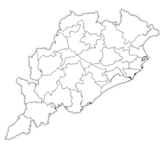
Odisha Map Image (Odisha Map with Districts)
Here is a list of districts in Odisha:
| Angul Balangir Balasore Bargarh Bhadrak Bolangir Boudh Cuttack Deogarh Dhenkanal Gajapati Ganjam Jagatsinghpur Jajpur Jharsuguda | Kalahandi Kandhamal Kendrapara Kendujhar (Keonjhar) Khordha Koraput Malkangiri Mayurbhanj Nabarangpur Nayagarh Nuapada Puri Rayagada Sambalpur Sonepur Sundargarh |
Here is the map of Odisha with its districts:

Bhulekh Odisha Map
Bhulekh is a digital land record system in Odisha that provides online access to land records, maps, and other land-related information. While you may not be able to find a Bhulekh Odisha map per se, you can access the Bhulekh Odisha website to view maps and land-related information.
To access the Bhulekh Odisha website, you can follow these steps:
- Go to the official website of Bhulekh Odisha – https://bhulekh.ori.nic.in/.
- On the homepage, click on the “View Map” option.
- You will be directed to a new page where you can select the district, tehsil, and village for which you want to view the map.
- Once you have selected the relevant options, you can click on the “Submit” button.
- The map of the selected village will be displayed on the screen.
The Bhulekh Odisha website also provides other land-related information such as landowner details, plot number, area of land, etc. You can access this information by clicking on the “ROR Front Page” option on the homepage.
Bhunaksha Odisha Map
Bhunaksha is a digital mapping portal for land-related information in India. It provides access to cadastral maps (maps showing the boundaries of land parcels) and other land-related data. In Odisha, the Bhunaksha portal is maintained by the National Informatics Centre (NIC).
To access the Bhunaksha Odisha map, you can follow these steps:
- Go to the official website of Bhunaksha Odisha – http://bhunakshaodisha.nic.in/
- Select the district and tehsil from the drop-down menu.
- Once you have selected the relevant options, the map of the selected area will be displayed on the screen.
- You can zoom in and out, pan the map, and toggle different map layers to view different types of information.
The Bhunaksha Odisha portal also provides other land-related information such as landowner details, plot number, area of land, etc. You can access this information by clicking on the “Land Record Management” option on the homepage.
Full HD Odisha Map

Odisha Map Drawing
Drawing an Odisha map can be a fun and engaging activity, especially for kids. Here are the basic steps to draw an Odisha map:
- Draw an outline of Odisha’s shape on a piece of paper using a pencil or a marker. You can refer to an image of the Odisha map as a reference.
- Mark the location of the Bay of Bengal to the east of the state and the states of Andhra Pradesh and Chhattisgarh to the south and west of the state, respectively.
- Draw the borders of each district within Odisha. There are 30 districts in Odisha, and you can refer to an image of the map of Odisha with its districts as a reference.
- Label each district on the map with its name using a pen or a marker.
- Mark the location of major cities such as Bhubaneswar, Cuttack, Rourkela, and Puri on the map.
- You can also add other details such as rivers, mountains, and forests to make the map more visually appealing.
These are just basic steps to draw an Odisha map. You can add your own creative touches and details to make your map unique and personalized.
High Resolution Odisha Map
FAQ – Odisha Map
What is Odisha Map?
Odisha Map is a geographical representation of the Indian state of Odisha, depicting its boundaries, districts, cities, towns, villages, water bodies, and other important physical features. It is a visual tool used for various purposes such as navigation, planning, education, and research.
How to use Odisha Map?
Odisha Map can be used for various purposes such as locating places, planning routes, identifying geographical features, and studying the state’s topography. It can be used both in digital and physical forms, and one can use it by referring to the legend and symbols provided on the map to understand the various features and information represented on it. Additionally, one can also use online maps and mapping applications to explore and interact with the Odisha Map, such as zooming in/out, searching for specific locations, and accessing additional information.
Why is this important Odisha Map?
Odisha Map is important for several reasons.
Firstly, it helps in providing accurate geographical information about the state of Odisha, including its boundaries, physical features, and administrative divisions. This information is useful for various purposes such as urban planning, disaster management, and natural resource management.
Secondly, it helps in navigating through the state, finding locations, and planning routes.
Finally, it is an important educational tool that can help students learn about the geography, culture, and history of Odisha.